City Council approves a new transportation goal and outcomes for The Way Ahead

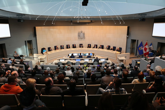
It’s no secret that LRT is City Council’s top infrastructure priority. They have repeatedly stressed the importance of expanding our LRT network, and scored a win recently with the Valley Line. LRT is part of a bigger transformation that Council hopes to realize, which is a shift away from the car-dominated transportation network we have today to a network that offers realistic choice through a range of travel options. At Wednesday’s City Council meeting, they approved a new goal for The Way We Move that makes this transformation clearer.

City Council Swearing In 2013-2017

In November last year, Edmonton’s new City Council took part in a series of strategic planning sessions. In addition to serving as a crash course on the City’s strategy and approach to long-term planning, the sessions were also a way to ensure the new Councillors were on board with the corporate outcomes, measures, and targets for each of the six 10-year goals identified in The Way Ahead. Among the key outcomes of those meetings were a desire by Council to review the goal statement for The Way We Move, as well as a desire to emphasize public engagement within The Ways.

The public engagement action is being handled through a new Council Initiative, and I think we’ll hear much more about that in the weeks ahead. I’m looking forward to it.

The goal for The Way We Move was reviewed and discussed at a couple of subsequent Council meetings, notably January 28 and March 11. Council wanted to stress the use of public transit, but they wanted to make it clear that Edmontonians would have choice. The goal they ultimately settled on reflects both of those desires and has led to a new set of outcomes too.

Current Goal: Shift Edmonton’s Transportation Mode

The current goal statement for The Way We Move is focused on “mode shift”, which is meant to convey that while the majority of Edmontonians get around the city using vehicles today, that should not always be the case. The reasons for needing a shift included changing our urban form to be more sustainable, accessibility, supporting active and healthy lifestyles, reducing the impact on the environment, and attracting business and talent to Edmonton.

Here’s the goal statement that accompanies the goal:

“Modes of transportation shift to “fit” Edmonton’s urban form and enhanced density while supporting the City’s planning, financial and environmental sustainability goals.”

Each goal also has an ‘elaboration’ associated with it. The current one for transportation reads:

“In shifting Edmonton’s transportation modes the City recognizes the importance of mobility shifts to contribute to the achievement of other related goals. To do so suggests the need to transform the mix of transport modes, with emphasis on road use for goods movement and transiting people and transit use for moving people. This goal reflects the need for a more integrated transportation network comprising of heavy rail, light rail, air and ground transport, and recognizes the important contribution that transportation makes to environmental goals.”

While the current wording attempts to connect with the other goals in The Way Ahead, it doesn’t as forcefully make the case for offering alternatives to single-occupant vehicles. The other challenge is that “mode shift” doesn’t mean anything to most of us, and sounds bureaucratic.

Perhaps more importantly, this was the only goal that was presented as if was worth doing solely to achieve the other goals. Surely a shift in how we move around the city should have benefits of its own!

New Goal: Enhance use of public transit and active modes of transportation

The new goal statement reads:

“Enhancing public transit and other alternatives to single-occupant vehicles will provide Edmonton with a well-maintained and integrated transportation network. Increased use of these options will maximize overall transportation system efficiency and support the City’s urban planning, livability, financial, economic and environmental sustainability goals.”

And the new elaboration reads:

“Through this goal, the City recognizes that a transportation system that is designed to support a range of travel options will increase the number of people and the amount of goods that can move efficiently around the city, while supporting the City’s goals for livability, urban form, financial, economic and environmental sustainability. Creating this 21st century sustainable and globally competitive city means offering choice. It will allow Edmontonians of all ages and abilities to safely walk, bike, ride transit, ride-share or drive to the places they need to go. The trade-offs needed to achieve this vision will create an integrated transportation system with greater travel choices for Edmontonians.”

The connection to the other goals is still present in the new wording, but not at the expense of highlighting the desire for alternatives to the car. There’s also the suggestion that trade-offs will need to be made in order to create a system that offers choice – we can’t have it all without making some hard decisions. The new goal is much more approachable now that “mode shift” is gone.

New Outcomes

Alongside this change, Council approved 12 new corporate outcomes, replacing the 20 that had previously been approved. Through their discussions, Council felt the outcomes should be specific and measurable, and provide a clarity of purpose. They wanted to simplify the approach. Here are the 12 outcomes they ended up with:

  1. Edmonton is attractive and compact
  2. The City of Edmonton has sustainable and accessible infrastructure
  3. Edmontonians use public transit and active modes of transportation
  4. Goods and services move efficiently
  5. Edmontonians are connected to the city in which they live, work, and play
  6. Edmontonians use facilities and services that promote healthy living
  7. Edmonton is a safe city
  8. The City of Edmonton’s operations are environmentally sustainable
  9. Edmonton is an environmentally sustainable and resilient city
  10. The City of Edmonton has a resilient financial position
  11. Edmonton has a globally competitive and entrepreneurial business climate
  12. Edmonton Region is a catalyst for industry and business growth

Gone are words like “minimized”, “supports”, or “strives”. The new language seems less open to interpretation, which is a good thing for determining progress. The next step is for Administration to prepare measures and targets based on these outcomes and to update The Way Ahead (there are currently 65 approved measures and 27 approved targets).

Results?

It’s great that Council wanted to strengthen the transportation goal and that they have simplified the outcomes. Most of this strategic planning was completed by previous Councils, so the exercise probably helped to ensure our current Councillors feel a sense of ownership. But the challenge remains: we need to implement the plans and see results. An annual report on progress will go to Council next year, based on the new outcomes, measures, and targets.

Transforming Edmonton: Shifting our focus from plans to implementation

Toward the end of 2006, the City of Edmonton started to look at refreshing its visioning and planning efforts. A number of major City plans were about to be renewed, including the Municipal Development Plan, the Capital City Downtown Plan, and the Transportation Master Plan. Administration explained the importance of these reports in an update to Council:

Major plans are plans of city-wide or corporate-wide significance.  Major plans act as foundation blocks for Administration decisions and recommendations to City Council.  They are also a fundamental building block for future Council decisions.  These plans are meant to be in place for multiple years, and the review of these plans takes significant time and resources by both Administration and Council.

A report published in early 2007 provided a more detailed update and proposed a method for developing a “Vision for the City of Edmonton” that would kick off a full planning cycle. The report also included a Strategic Planning Brief. Here’s a look at the proposed strategic development cycle:

And here’s a look at the proposed framework process:

Writing in the Edmonton Journal about public information sessions held by the City in October 2008, Todd Babiak noted:

This process, which also includes the City Vision for 2040, the 10-year strategic plan, the Ecovision, and the plan for downtown, is broadly called "Transforming Edmonton." We’re admitting, as a people, that we have made expensive and dangerous mistakes for a generation or so.

Mary Ann McConnell-Boehm, who managed the Municipal Development Plan at the time, said:

"This is what we heard from our stakeholders in 2006, about the direction they wanted our city to take. A different approach, more integrated, a little braver."

That more integrated process ultimately led to the creation of the City Vision, the City’s Strategic Plan for 2009-2018 known as The Way Ahead, and the associated “Ways” plans:

Many Edmontonians have noted that the last plan to be approved, The Way We Finance, is the one that’s supposed to help us pay for the rest! Still, when its approval finally happens later this year, it’ll bring the most ambitious planning cycle in the City of Edmonton’s history to a close.

There were previous efforts at establishing a city-wide vision of course, such as the “Smart City” initiative of the late 90s, but none stuck. Why did Transforming Edmonton succeed at getting off the ground when other initiatives had failed? I think a big reason was Mayor Mandel. After winning re-election in October 2007, Mayor Mandel told the Edmonton Journal:

“The vision we have is of Edmonton being a city of the world. A city that is vibrant, environmentally sensitive and attractive. And a city that cares about people and opens its arms to them, wherever they came from.”

The importance of Mandel’s victory did not go unnoticed by the Edmonton Journal’s Scott McKeen, who wrote:

Mandel’s win, though hardly a surprise, was much more than a ho- hum victory over the fringers, fanatics and languid Koziaks who ran against him.

His approval rating on Monday narrates a turning point in Edmonton’s history. If Mandel’s first term stood for anything, it was a shift away from historic nickel-and-dime civic politics.

Edmontonians, it seems, embrace Mandel’s big-city vision.

The success or failure of an effort as broad and ambitious as Transforming Edmonton cannot be attributed to one person of course, but under Mayor Mandel’s watch, the City became a bit more integrated and much more strategic.

Edmonton’s efforts at improving the visioning and planning process are not unique. Vancouver’s CityPlan was adopted in 1995 and is slated to come to a close in 2015 (to be replaced with Green Vancouver, I think). Toronto’s Strategic Plan was approved in three stages from 1999-2001. Ottawa adopted its Official Plan in 2003 to guide the city through 2021. Montreal’s Master Plan was adopted in 2004. Calgary adopted imagineCALGARY in 2006, which sets out a 100 year vision with targets every 30 years. Winnipeg replaced its previous Plan Winnipeg 2020 initiative with OurWinnipeg in 2011, presenting a 25-year vision for the city. Long-term planning seems to be the norm for Canada’s major cities.

Today nearly every aspect of the City of Edmonton’s operations have been affected by Transforming Edmonton. For example, every budget item references one of “The Ways” and/or the strategic goals, and internal structures have changed to match the new approach. We’ve also seen efforts to describe progress, such as the new Citizen Dashboard.

While some implementation has occurred, the focus of the last five years has unquestionably been on the creation of Transforming Edmonton’s plans and associated documents. The approval of the final major plan, not to mention the expected retirement of Mayor Mandel next week and April’s unofficial kickoff of campaigning for the October municipal election, should signal a shift toward more concerted implementation efforts.

A shift in focus from planning to implementation won’t just happen, however. Edmontonians need to demand it. We as citizens need to do a better job of asking how things are going, not just how things are going to be.

Meet me on the bridge: The Edmonton City Centre Redevelopment

It was 1974 when City Centre Place was completed, part of the Edmonton Centre development across from Churchill Square. The shopping mall we now know as Edmonton City Centre has had an interesting history, to say the least. TD Tower was added to the complex in 1976, and Oxford Tower and the Sutton Place Hotel followed in 1978. As Christopher Leo notes (archive), downtown was the place to be back then:

In the 1970s, downtown Edmonton was the retail centre of the metropolitan area, and the city had a policy of sustaining that role by supporting the viability of residential neighbourhoods near the centre of the city and placing limits on the amount of permitted suburban shopping centre development.

The development of West Edmonton Mall by the Triple Five Corporation in the 1980s had a significant negative impact on downtown Edmonton, and on the City Centre mall in particular. The policy limiting suburban shopping centre development was forgotten. As a result, efforts to restore life to downtown began and Triple Five came along with a solution: Eaton Centre. Christopher has documented the ups and downs of that project very thoroughly, so suffice it to say that what was eventually built in 1987 was a mere shadow of the original vision.

The two malls staggered along until 1999 when the Eaton’s chain went bankrupt. It was around that time that Randy Ferguson came to Edmonton on a mission to straighten things out. He remembers his boss at Oxford Properties, Jon Love, telling him two things before he left. “Go get the job done in the best interest of the community and this company,” and “remember one thing: that’s my hometown”. Randy’s journey began on January 2, 2000.

“There was very little energy downtown,” he recalled. Eaton Centre and Edmonton Centre had separate identities. Thinking back to the amount of space they took up downtown Randy told me how he felt: “it was depressing.” He had a job to do however, and his first task was to convince the Oxford board that they should spend money in Edmonton, their weakest market. “We said, don’t think about this as a retail play.” Randy pointed out that 40% of the office space downtown fed into the property. Four office tower lobbies and two hotels directly. The board gave Randy the go-ahead, but with a budget of just $44 million.

Randy and his team made a number of big changes over the next few years. Randy felt that a department store facing Churchill Square was inappropriate, so they convinced The Bay to move to the other side of the mall, to the vacant Eaton’s location. They turned the basement of the now empty east side into a parkade, and managed to attract Sport Check, Winners, and CBC. There were challenges along the way, of course. In the fall of 2001, Randy had arranged to have the western executives in charge of CBC’s TV and Radio divisions come to Edmonton so that he could pitch the idea of consolidating CBC’s properties in the mall downtown. The morning of the presentation was September 11. Needless to say the deal didn’t happen until many months later!

City Centre Wide Bridge

Merging the separate Eaton Centre and Edmonton Centre identities was an important aspect of the redevelopment. Randy wanted to do something architecturally to combine the two properties, and thought about a pedway bridge. “I think our bridges are terrible,” he told me. “They’re ugly, utilitarian, and generic.” In fact, Randy dislikes our pedway bridges so much that he pitched the idea of wrapping each one in scenes depicting the events taking place at the 2001 World Championships in Athletics. Unfortunately, the City didn’t go for it.

Randy wanted the bridge joining the properties to be more than just a pathway, he wanted it to be iconic. That’s how he came up with the wide bridge concept. “I wanted it to become the meeting place,” he recalled. “You know, ‘let’s go for coffee…meet me on the bridge!’” He envisioned a Starbucks and a patisserie on the main level of the bridge, with the rest of the space available for seating. They built a second level as well, a space that Randy thought would make an excellent wine bar. “We put two circular staircases on the bridge, ran power, and even roughed in plumbing.” As it turns out, Randy’s vision was never fully realized. “It has never been programmed the way I imagined it.” Today the bridge is home to a Tim Horton’s, a Telus Mobility kiosk, and a few retailers including a Bell store. The second level is empty and inaccessible. That’s unlikely to change anytime soon, due to the leases that are in place.

Edmonton City Centre Wide Bridge

Randy and his team had to be creative in order to achieve everything they wanted with the redevelopment project, which was finished in 2003. “We accomplished an $80 million spend on a budget of $44 million,” he said. He had spent some time studying funding programs elsewhere in North America, and came across a tax increment financing (TIF) project in Florida. “I liked it because it had a direct connection to rehabilitating the area, and it had a sunset, it wasn’t forever.” Randy worked with Al Maurer, City Manager and Randy Garvey, then the GM of Finance at the City of Edmonton, to see if he could make such a program work here. Alberta’s CRL legislation didn’t exist yet, so they could only apply the tax increment from the City to the project, the school taxes could not be touched. They followed the sunset model, whereby 100% of the tax increment went to the project in year one, 90% in year two, and so on. Randy thinks it might be the first example of a TIF used in Alberta.

City Centre Wide Bridge

When the time came to build the wide bridge, Randy again was out of money. Recognizing that it technically wasn’t on land that Oxford owned, they applied for a local improvement levy. The City studied the legislation and agreed that the funding mechanism was appropriate, so that’s where the money for the bridge came from. Further funding for the redevelopment project came through the creative use of a Commercial Mortgage Backed Security, something that would never happen today given the current recession.

Given his history with the concept, I asked Randy for his thoughts on the idea of using a CRL to help pay for the downtown arena. “I am a huge fan of CRL or TIF – it can make things happen that otherwise wouldn’t.” He doesn’t think the proposed formula is the best one, however. “I believe the school tax portion of CRL should be sacred, it shouldn’t be in play,” he told me. Randy also feels the sunset approach is better than 100% for 20 years as the current legislation allows. “We need to benefit from that growth, along with the guys that are making the investment.” He suggested that the City should get some local experience at the bargaining table, someone like Randy Garvey.

Randy supports the proposed arena project, even though it is competition for ProCura where he is COO. “It’s about critical mass. It’s about creating a new day.”

Alberta’s Community Revitalization Levy: Rivers District, Belvedere, The Quarters

This is the second part in a three-part series on Alberta’s CRL.

Armed with a better understanding of Alberta’s CRL legislation, I turned my attention to the three active CRL projects in the province. What are the projects for? Why is a CRL appropriate for them? What can we learn from the projects that will help us when exploring the idea of using a CRL in the future? That’s some of what we’re going to look at in this post.

To quickly recap the process: there is some back-and-forth between the city and the province in establishing a CRL. First, the Lieutenant Governor must approve the regulation, which includes the CRL boundary. Second, City Council must approve the plan & bylaw for the CRL (and these can be done separately). And finally, that plan & bylaw must also be approved by the province. The three projects we’re going to look at are at different stages of that process.

Calgary’s Rivers District

The first specific CRL regulation to be passed in Alberta was for the City of Calgary Rivers District, back in 2006. The Rivers District project was the catalyst for the MGA amendment that made CRLs possible in Alberta.

 City of Calgary Rivers District Community Revitalization Levy Regulation (AR 232/2006)

The Rivers District is the furthest along of all the CRLs in Alberta – everything has been approved and the City is well into implementation. It was 2007 when everything was finally approved, so the baseline for tax assessments would have been frozen to the values on December 31, 2007.

It’s worth pointing out that the CRL is just a small part of a much larger project known as The Rivers:

The vision for a revitalized Rivers district is more than a place to live, it is a lively urban destination.

This map shows the area the project covers, and as you can see, it is quite expansive. The idea is to reclaim the waterfront, and to make the area more desirable for development. In addition to infrastructure upgrades, a new riverwalk is in the works (phase 1 is now open actually).

The CRL boundary is large, but it is a small part of the overall project. Here’s what it looks like (KML):

The boundary covers an area of roughly 1.9 square kilometers (478 acres).

One of the big advantages to using a CRL for the Rivers District is that the City of Calgary owned much of the land within the boundary. That’s important because it means the baseline assessment for those assets would be zero, and there’s lots of potential for getting some of that all-important lift.

I spent some time talking with Kathleen Young, Development Manager for The Quarters Downtown at the City of Edmonton, and found out that she actually worked on the Rivers District CRL! Her knowledge and experience on that project was one of the reasons that she came to Edmonton. You know what they say, it’s a small world.

Kathleen pointed out that the CRL boundary for the Rivers District includes some key developments, notably The Bow (here’s a photo of the building I took back in July). When finished, The Bow will become the headquarters for EnCana, and will be the tallest office building in Canada outside Toronto. Groundbreaking for the project took place in June 2007, around the same time that the Rivers District CRL was approved, which means almost all of the incremental value realized through the development of the building will be captured by the CRL.

To work on The Rivers, the City of Calgary created a wholly owned corporation called the Calgary Municipal Land Corporation (CMLC). They have some great information on the various aspects of the project if you’d like to learn more. CMLC was actually awarded a Canadian Urban Institute Brownie Award in 2008 for the CRL:

The Canadian Urban Institute’s annual Brownie Award recognizes leadership, innovation and environmental sustainability in brownfields redevelopment across Canada. CMLC won in the category of "Financing, Risk Management and Partnership" for our work in the creation of the Rivers District Community Revitalization Levy Regulation. A "made in Alberta" version of the U.S. Tax Increment Financing (TIF)— which is a widely used financing mechanism for redevelopment of brownfield sites in the United States—provides a sustainable source of funding to finance the significant infrastructure development required in the Rivers District for a 20-year period.

It sure looks like the Rivers District CRL will be a success!

Belvedere (Fort Road)

The first CRL regulation to be passed for Edmonton was for the Belvedere redevelopment project, commonly known as the Fort Road Redevelopment project. The project has been in the works since at least 2000, and has evolved quite a bit over the last decade. It was very much in the works before CRL legislation came into effect.

 City of Edmonton Belvedere Community Revitalization Levy Regulation (AR 57/2010)

The Belvedere CRL isn’t quite as far along as the Rivers District, but it is nearly there. Kathleen clarified that the borrowing bylaw (14883) has been approved, but the plan bylaw is still in the works. Armed with the $34,250,000 specified in the borrowing bylaw, the City has undertaken much of the infrastructure upgrades planned for the area.

Here’s the CRL boundary for the project (KML):

The boundary covers an area of roughly 1.3 square kilometers (324 acres).

A unique element of the Belvedere CRL is that the City owns almost all of the land within the boundary. As a result, when they sell the land all of the incremental value will be captured by the CRL, making it much less likely that the City would have to fall back on general revenue to cover the debt.

The Belvedere project is an interesting one. It is unlikely that development would have taken place in the area without the City of Edmonton stepping in to try to make the area more attractive and desirable. Through that lens, the use of a CRL makes a lot of sense. If you think back to the two basic assumptions highlighted in part one, the Belvedere CRL certainly passes the first – it’s worth the risk.

As for the second assumption – there’s a sound expectation that development will occur – that one is less certain. Especially given the challenging economy, it could be a while before anything substantial happens. Having said that, the first sale of the Station Pointe lands last year for $5.2 million is hopefully a sign of things to come (that project received $481,000 in federal funding in August). The redevelopment project is still in the early stages, and Rick Daviss at the City of Edmonton confirmed that at least a couple new conditional deals are in place, so there’s movement.

There’s more information on the Station Pointe project here – it won a Brownie Award in 2008.

You can find lots of background and other information on the Fort Road redevelopment project here.

The Quarters

The newest CRL regulation to be passed was for The Quarters Downtown, a redevelopment project here in Edmonton previously known as the Downtown East redevelopment. I wrote about The Quarters a couple weeks ago, and I’d encourage you to look at that post to get an overview of the project.

 City of Edmonton The Quarters Community Revitalization Levy Regulation (AR 173/2010)

As the newest CRL project, The Quarters has the furthest to go before it is ready for implementation. The province has approved the regulation and boundary, and Administration is now working on the plan and bylaw to present to Council. That will happen sometime in 2011, according to Kathleen. Her team wants to make sure they get it right.

Here is the CRL boundary for the project (KML):

The boundary covers an area of roughly  0.93 square kilometers (229 acres).

The Quarters is a large plan that will proceed in phases. Once completed, it is anticipated that the area will accommodate a population of nearly 20,000 people, up from less than 2500 today. The project is made up of five distinct districts, the jewel of which is known as The Armature.

An important part of any CRL plan is the way in which the City will cover the cost of the project if enough development does not occur. The default fallback is always general revenue, but Kathleen said they are looking at additional funding sources as well, such as government grants.

Kathleen told me that among other things, some of the CRL money will be used for streetscape improvements, some will be used for land acquisition to consolidate parcels for resale, and lots would be used to develop The Armature. The goal is to make that part of Edmonton a much more livable area, and the redevelopment focus is on residential assets.

As I have said before, it is an exciting project for our city! You can learn more about The Quarters Downtown here.

The project will be an interesting one to pay attention to if you’re interested in CRLs, because there are still a number of steps in the process to go.

Final Thoughts

If you’ve made it this far, you should now have a better understanding of the three active CRL projects in Alberta. You can draw your own conclusions, but a few things I wanted to highlight include:

  • All three boundaries are similarly sized
  • Infrastructure upgrades and improvements are a major part of all three projects
  • In the Rivers District and Belvedere, and to a lesser extent in The Quarters, an important consideration is the amount of City-owned land

I think it is important to look at what we already have when trying to understand how a CRL could be applied to future projects. In the next part of the series we’ll do just that, using the proposed downtown arena as our future project.

Alberta’s Community Revitalization Levy:

  1. Introduction
  2. Rivers District, Belvedere, The Quarters
  3. Proposed Downtown Edmonton Arena District

Alberta’s Community Revitalization Levy: Introduction

This is the first part in a three-part series on Alberta’s CRL.

Recently I decided to start learning more about Alberta’s Community Revitalization Levy (CRL), and I was initially struck by how little information was readily available. I searched and searched but didn’t find much. Maybe that’s because what we call the community revitalization levy here in Alberta is known as tax increment financing (TIF) elsewhere. It turns out that TIF has been available as a public financing method for more than 50 years! The State of California first used the approach in 1952, and now Arizona is the only state in the USA without some sort of TIF legislation.

Here’s how Wikipedia describes TIF:

When a development or public project is carried out, there is often an increase in the value of surrounding real estate, and perhaps new investment (new or rehabilitated buildings, for example). This increased site value and investment sometimes generates increased tax revenues. The increased tax revenues are the “tax increment.” Tax Increment Financing dedicates tax increments within a certain defined district to finance debt issued to pay for the project.

The idea is to use the “lift” generated by the increased tax revenues to pay for the debt that financed the project.

Alberta’s CRL

In Alberta, this legislation is relatively new. Bill 28 received Royal Assent on May 10, 2005 and amended the Municipal Government Act (PDF) to include Division 4 under Section 381, which enables municipalities to create a community revitalization levy bylaw (which must be approved by the Lieutenant Governor in Council).

Since that legislation came into effect, there have been three CRLs created in Alberta (as far as I can tell): Calgary’s Rivers District, the project for which Bill 28 was created, and the Belvedere (Fort Road) and Quarters redevelopment projects here in Edmonton. You can read more about all three projects in part two.

There are a few key aspects of the CRL to be aware of:

  • The CRL only applies to a very specific area (the CRL boundary).
  • The tax revenue that contributes to the CRL is split between the City and the Province.
  • The maximum amount of time a CRL can exist is 20 years, starting in the year when the bylaw is approved by the Lieutenant Governor in Council.
  • The Lieutenant Governor in Council can approve a CRL bylaw in whole or in part or with variations and subject to conditions.

And don’t be mislead by the name “levy” – the CRL is a tax as defined in the MGA. It’s a funding mechanism, nothing more.

From my read of the Municipal Government Act, there are no rules or restrictions on the type of area that a CRL can apply to. In theory a CRL works best in an area that is “blighted” but the legislation does not enforce this. This was the case in California as well, until it became clear that the legislation was being abused.

What’s the potential impact of a CRL?

I asked Rick Daviss, Manager of Corporate Properties at the City of Edmonton, to help me understand the CRL. He was very helpful and pointed me in the direction of some very useful information.

The first thing we looked was a hypothetical example of the impact of a CRL. Here’s the situation:

  • Current use: 2.0 acre parcel of land improved with a 30,500 square foot warehouse.
  • Proposed use: 2.0 acre parcel of land improved with a high rise residential condo development (proposed density of 265 units (RA9), FAR of 3.0, unit value assessed at $200/square foot).

So we’ve got an old warehouse on some land and we want to replace it with a condo. Let’s look at the assessed value:

  • Current use: $1,525,000 (this is known as the assessment baseline)
  • Proposed use: $44,431,200

Which gives us an increase in value of $42,906,200. Now let’s look at the tax assessment:

  Before After Difference
2006 Municipal Mill Rate 5.7484 5.7484
2006 Municipal Tax $8,766 $255,408 $246,642
2006 School Mill Rate 3.6182 3.6182
2006 School Levy $5,518 $5,518 $0
2006 CRL N/A $155,243 $155,243

The mill rate is used to calculate the property tax, and you can think of it as the amount of tax required divided by the amount of tax available. So if the City needs $2 billion in taxes but only $1 billion can be generated based on the assessments, the mill rate is 2. The property tax is then calculated by multiplying the assessed value by the mill rate, and dividing by 1000. So to get $8,766 in our example above, $1,525,000 is multiplied by 5.7484 and then divided by 1000.

Let’s look at the Before column first. The total tax assessment there was $14,284, and the two bottom rows are N/A because we don’t have a CRL in the before case. Both the City and School taxes are calculated the same way: assessed value multiplied by the mill rate divided by 1000. The province gets $5,518 and the City gets $8,766, all of which goes into what’s known as “general revenue”.

Now let’s look at the After column. The total tax assessment there is $416,169. The City tax is calculated the same as before, but now that we have a much higher assessed value, we end up with $246,642 in increased tax revenue. All of this will go to the CRL. The School tax is broken into two, because only the incremental tax revenue will go toward the CRL. So the $5,518 is calculated the same as in the Before case, and this goes to the province. The provincial part of the CRL is calculated as follows: the increase in assessed value ($42,906,200) multiplied by the mill rate divided by 1000. That gives us the $155,243, all of which will go the CRL.

So now you see why the CRL is such an attractive proposition: it looks like we have $401,885 in new tax that we can contribute to the CRL. And this could happen with all developments inside the CRL boundary. There are a number of caveats, however. The first is that the CRL amount will vary from year to year based on the assessment (which makes the economy and depreciation relevant) and on the school mill rate which also changes from year to year. The second is that the type of development is important – City owned properties are tax exempt, for instance. A third is that the City tax revenues as well as a portion of the School tax revenues are dedicated to the CRL, where they would otherwise have gone into general revenue.

How is a CRL created?

Rick walked me through the process of creating a CRL, and I can tell you it sure doesn’t sound like a trivial task. In the best case, Rick estimates it would take just less than two years from concept through to the start of implementation to make a CRL reality. Here’s a high-level overview of the process:

Those five steps would include, roughly:

  1. Administration conducts background research, identifies the potential boundary, comes up with preliminary revenue estimates, and prepares for and asks Council for approval to make a request to the Minister of Municipal Affairs.
  2. The Minister of Municipal Affairs considers the request and recommends an Order in Council for an establishment regulation. This step also includes some back and forth to establish the area and other parameters.
  3. The Lieutenant Governor in Council considers and approves the Order in Council for the area to be established.
  4. Administration conducts more research, holds public hearings, drafts the proposed bylaw, has it reviewed by all relevant departments as well as the province, and acquires Council approval of the bylaw.
  5. The Lieutenant Governor in Council approves the bylaw.

After all that is done, the CRL can proceed. It makes sense to plan for the Lieutenant Governor in Council’s final approval as close to the start of construction as possible, in order to get the maximum possible time under the CRL legislation.

What are the risks associated with a CRL?

As others have pointed out, a CRL is not a risk-free proposition. There are a number of issues to consider.

What if a project does not lead to an increase in property values and does not result in any new development? In this case, there would be no “lift” to pay down the debt of the project. Rick noted that a plan for this kind of scenario needs to be in place before the province will approve a CRL. It can be as simple as the City swallowing the cost of the project, as long as it can specify how it will be paid for. Another option is for a third party to backstop the plan.

Another issue is the potential shift in taxes. Will the project really result in new development – development that would not have occurred in the city otherwise – or is it merely a shift in development, from areas outside the CRL to the area inside the CRL boundary? How would you know, one way or the other?

A related issue is the decrease in general tax revenue. If the property tax inside the CRL boundary is no longer going into general revenue, what does that mean for the services the City provides? In the worst case, you can imagine the entire City being covered in various CRL projects. That would result in zero general tax revenue and thus no way for the City to pay for the services it provides to citizens. What is the impact of one or two CRL projects? That’s less clear. Same goes for the school taxes. A common concern for many people is that they don’t want their school taxes going toward the CRL instead of schools. Of course, in reality the province doesn’t come up with education programs based on the amount of school tax it receives – tax revenue does go into the Alberta School Foundation Fund, but that money is combined with whatever amount of general revenues the province deems appropriate.

Can a CRL really work?

For a CRL to work, Rick says you need to make two basic assumptions:

  1. The project the CRL would be funding is a good thing, and is worth the risk.
  2. There’s a sound expectation that development will occur as a result.

If you think the project is worth the risk, and you’re confident that development will occur as a result of taking that risk, then a CRL can be a good funding source. Rick highlighted the Belvedere (Fort Road) project as meeting this basic criteria: it’s an area that needs to be redeveloped and it’s unlikely that anything would happen without some initiative by the City, plus there’s a good chance that other development will occur now as a result of the City going in and cleaning things up.

Final Thoughts

If you’ve made it this far, you should now have a better understanding of how Alberta’s Community Revitalization Levy came to be, how it works, and what the potential impacts and pitfalls of the legislation are.

In the next part of this series, we’ll look at Alberta’s three current CRL projects in more detail.

Alberta’s Community Revitalization Levy:

  1. Introduction
  2. Rivers District, Belvedere, The Quarters
  3. Proposed Downtown Edmonton Arena District

Quarterly Update on the City Centre Airport Redevelopment

Today the City of Edmonton provided an update on the City Centre Redevelopment. Phil Sande, the project’s executive director, gave a brief overview of the report (PDF) that will go to Council on Friday, and was available to the media for questions. As you can see, the project now has a logo!

Phil talked most about the process for the design competition. Submissions from the five finalists are due on January 21, 2011, and are to contain display material, a five-minute video, and written content. Each finalist must also make a case for why they should be chosen. Here are the updated dates:

  • January 21, 2011: Submissions from finalists due.
  • January 24/25, 2011: Submissions should be available to the public online.
  • January 28 – February 6, 2011: Submissions will be on display at City Hall (and other locations).
  • February 8-10, 2011: Selection Committee will review the submissions and interview each team.
  • March 2011: Recommendation from Selection Committee will go to City Council.
  • April/May 2011: Winning submission selected and contract negotiations begin.

The winning submission will then undergo a 15 month “master plan process” which will include extensive public involvement. After that process is complete, the City will have more reliable numbers for both number of residents and potential tax revenue from the redevelopment. Tenders for construction of the first phase of the project could go out as early as the summer of 2013, with utility work beginning around the same time.

Phil Sande, CCR

There’s an update on the environmental analysis in the report:

The Phase II Environmental Site Assessment on the east portion of Edmonton City Centre Airport site identified three locations where there are contaminants above acceptable criteria. A risk management approach is being applied to these sites, which means no remediation is necessary until such time as the site is redeveloped.

There were lots of questions about the updated revenue estimates for the redevelopment. Here’s what the report says:

Based on current development practices, upon full build out, preliminary estimates suggest that the City Centre Redevelopment will generate annual tax revenues in excess of $20 million per year and generate net sales revenues in excess of $70 million.

Phil stressed that we’ll have better information after the master plan process, and that the estimates are conservative and very approximate. He cited a change in parameters (notably the amount of land set aside for institutional use, and an increase in the amount of residential use and thus a decrease in the more lucrative commercial space) as contributing to any differences from previous estimates.

Here’s what Economic Impact Analysis (PDF) from June 2009 said:

The overall benefit to the City of Edmonton resulting from redevelopment of the ECCA lands is estimated to total $93 million (2009 $ net present value over 35 years using a 10% discount rate).  This benefit is expected to range between $55 and $168 million when the discount rate applied to future costs and revenues is varied by ±3%.

You can find all the other relevant documents here. It’ll be interesting to see how these numbers change as we learn more, but right now, they don’t seem that far off from where we were at last year.

Phil said that the redevelopment is still a vitally important project for the City of Edmonton, one that will bring a number of benefits to Edmontonians. His team has not received anything from the finalists in the design competition just yet, but it sounds like they are hard at work. I look forward to seeing what they have come up with in January!

UPDATE: Here’s a PDF document that outlines the range of redevelopment opportunities as they were envisioned in 2009. The net revenues of the options range from $91 million to $486 million.

UPDATE2: Another update from the City, received this evening:

Previous estimates of City revenues ranging from $91M to $486M remain accurate. These are based on the City acting as developer in four possible redevelopment scenarios. The anticipated revenue from the sale of the land as reported in the update is $70M. This number is based on the City selling the land to a developer, rather than acting as the developer itself, as is intended. The option for the City to simply sell the land was not one of the previous four redevelopment scenarios, and should not have been included in the quarterly update report. It is not an option the City is considering.

Recap: Walterdale Bridge & West Rossdale Open House

Last Thursday the City of Edmonton held an open house to discuss and gather feedback on two projects that will have a big impact on our river valley. The Walterdale Bridge, which has served Edmonton for nearly 100 years, is reaching the end of its usable life and needs to be replaced. The bridge connects the south side to Rossdale, the western part of which has been “rediscovered” and for which a new urban design plan has been created.

Held at the TransAlta Arts Barns, I thought the open house was fairly well-attended. I stayed for the first half, and by the time I left, around 120 people had signed in. Unfortunately the Walterdale Bridge presentation went long, so I didn’t learn much about West Rossdale other than what was shared on the information display boards. You can learn more about the West Rossdale Urban Design Plan here.

Walterdale Bridge & West Rossdale Open HouseWalterdale Bridge & West Rossdale Open House

The Walterdale Bridge Strategic Planning Concept Study of 2008 concluded that the bridge is now too old to be rehabilitated, and must be replaced. These images of the current Walterdale Bridge come from Bing Maps:

Walterdale Bridge

Walterdale Bridge

It may be old, but I think the current Walterdale Bridge is distinct and recognizable.

The concept design for the replacement bridge calls for a “functional signature bridge”. Key design considerations include:

  • Access/traffic accommodation from 82 Avenue to 97 Avenue.
  • Grades at south approach.
  • Detours and closure impacts, utility staging.
  • Aesthetics – signature bridge.
  • Traditional Burial Grounds and Fort Edmonton Cemetery Commemoration Site, historical resources.
  • North Saskatchewan River Valley plans.
  • Environmental policies and procedures.
  • Integration with West Rossdale Urban Design Plan, EPCOR Rossdale repurposing, EXPO 2017 bid, and other area plans.
  • Pedestrian and cyclist accommodation.

Walterdale Bridge & West Rossdale Open HouseWalterdale Bridge & West Rossdale Open House

To date, the City has conducted meetings/interviews with 14 key stakeholder groups, including twice with Aboriginal Elders with a pipe ceremony.  As you might expect, a wide range of issues have been raised in those stakeholder meetings, but this comment nicely sums it up:

The challenge for this project is to achieve a balance between providing improved access for private vehicles to downtown Edmonton and protecting/preserving the character, safety and integrity of the communities that the roadways approaching the bridge replacement will be impacting.

There were four options presented at the open house, though they weren’t mutually exclusive (PDF, 3.9 MB). Attendees were encouraged to leave feedback using sticky notes, and if they liked the south side of one option but the north side of another, the City representatives wanted to hear that. There are four bridge types being considered: girder, arch, extradosed, and cable-stayed (PDF, 320 KB).

Walterdale Bridge & West Rossdale Open HouseWalterdale Bridge & West Rossdale Open House

All four alignment options get rid of the hairpin at Saskatchewan Drive and Queen Elizabeth Park Road. The first three options shift the bridge to the east slightly, whereas option four would see the replacement built significantly further east than the current bridge. Of the four options, the first seems to have the smallest impact.

I’m encouraged by the lip service paid to pedestrians and cyclists during the open house, and I hope that translates into tangible benefits for those two important types of travelers once the replacement is built. It was also encouraging to hear that 1% of the total cost of the bridge will be allocated to public art.

In the presentation, a “signature” bridge was described as one that Edmontonians feel proud of. While that’s a fair definition, I really wonder why we’d build something we’re not proud of. It seems to me that what is meant by “signature” is something different, perhaps something more along the lines of the new Art Gallery of Alberta. I think a signature bridge is one that gets Edmontonians and others talking about it.

Walterdale Bridge & West Rossdale Open House

The next steps for the Walterdale Bridge project are as follows:

  • An interim plan, with three options, will go to the Transportation & Public Works Committee in January 2011.
  • Additional public information sessions will take place in February/March 2011.
  • A final recommendation will go to City Council in April 2011.

Even without EXPO 2017, we need to replace the Walterdale Bridge, so I’m not sure what impact, if any, that loss will have on the project. The Walterdale Bridge is an important, busy bridge here in Edmonton. If you have feedback on how the replacement bridge should look or function, let the team know.

Transforming Edmonton’s Downtown East: Boyle Renaissance & The Quarters

Last week I stopped by the open house for Boyle Renaissance & The Quarters, two projects that together will transform the eastern part of Edmonton’s downtown. The Quarters is a revitalization project made up of five distinct districts, extending east-west from 97 Street to 92 Street and north-south from 103A Avenue to the top of the river valley (approximately 40 hectares). Boyle Renaissance is a smaller redevelopment effort, focused on the area between 95 Street and 96 Street, from 103A Avenue north to the LRT tracks (essentially two and half city blocks).

There were maybe 20 people in attendance, not counting the City officials and representatives from the related architectural firms. In addition to the more than 25 information displays setup around the room, there were a number of small presentations on the plans.

Boyle Renaissance / The Quarters Open House

An update on Boyle Renaissance:

  • Boyle Renaissance started with a Concept Plan in 2008, and is now an evolving Master Plan composed of two phases. The project will create a community that brings together affordable and market housing opportunities, along with services such as childcare, park space, and social space.
  • The first Boyle Renaissance Advisory Committee (BRAC I) started meeting in May 2008. Its final report was submitted to the City of Edmonton in October 2008.
  • Council directed that the concept continue to evolve, so BRAC II was formed in March 2009. Its final report was published in March 2010. You can see the recommendations to council here.
  • Phase 1 project partners include The City of Edmonton, Government of Alberta, YMCA, Boyle Street Community League, and the Capital Region Housing Corporation (CRHC), among others. The Edmonton Oilers Community Foundation is no longer involved in the project.
  • The YMCA Welcome Village is a key component of phase 1, and will include 150 affordable housing units, a family resource centre and a daycare. The City is contributing $3.5 million while the Government of Alberta has committed $24 million.
  • The City of Edmonton is also contributing $6 million towards a new Community Centre, a joint initiative with the Boyle Street Community League.
  • Though none have come forward yet, the City is actively looking for potential partners to occupy the York Hotel building.
  • Updated documents aren’t online yet, but you can see the information displays here.
  • “We’re not building buildings, we’re helping to build a community.”


Part of the current Boyle Renaissance site plan, facing north.

A ground breaking ceremony for phase 1 is taking place on Wednesday morning.

Boyle Renaissance / The Quarters Open HouseBoyle Renaissance / The Quarters Open House

An update on The Quarters:

  • The revitalization project began in 2006, with the Area Redevelopment Plan being passed in April 2009.
  • The Quarters is one of the first areas in Edmonton to have a community revitalization levy (CRL). The boundary was approved in 2008. It is expected that final approval of the CRL from both Council and the Province of Alberta will come in 2011.
  • Once fully developed, it is anticipated that The Quarters could accommodate a population of nearly 20,000 people. The area is currently home to just 2400 residents.
  • The area is made up of five districts: four quarters, with a linear park corridor known as The Armature at the centre.
  • The Civic Quarter is envisioned as as an extension of the downtown and arts district. The Heritage Quarter is named for the location of Edmonton’s original downtown. The McCauley Quarter will contain smaller scale buildings and is largely residential. The Five Corners Quarter is named for the intersection at 95 Street and Jasper Avenue, and will feature taller buildings and a higher overall density.
  • The Armature itself is composed of smaller pieces, from north to south: Meridian Gateway, New City Park, The Promenade, Jasper Plaza, and River Gate Park. Principles identified in the presentation include: sustainable, accessible, green, seasonal, brighter, and creative.
  • The Armature was described as the “showpiece”.
  • The Twin Towers at Jasper Avenue and 95 Street will add to the density of the Five Corners Quarter.
  • Though each quarter will have a unique character, there are plans to “brand” the entire area, so you know when you’re in The Quarters.

Here are a few images I pulled from the Urban Design Plan (16 MB PDF).


Rendering of The Quarters.


Zoning for The Quarters.


Rendering of Five Corners.

Though some might say it has been in the works for too long, The Quarters is a very exciting project for Edmonton. The area east of downtown is definitely in need of revitalization, and this plan to bring thousands of residents into the area will help accomplish that.

Boyle Renaissance / The Quarters Open House

It’s a shame that the beautiful information displays shown at the open house are not available online (at least not yet). Hopefully we’ll see more information about these projects online soon!