How I travelled in 2012

Lattes weren’t the only thing I decided to track in 2012! I also decided to track how I much I travelled over the course of the year. One reason I wanted to do so was simply for my own knowledge! I think if you really want to change something, you need to first measure it. I figured if I could compare how often I drive with how often I choose other methods, I might be more inclined to change my behavior. Another reason was to hopefully inspire others to look at their own habits.

111 Street Pedway
Cars, buses, LRT, and good old fashioned walking! Photo by Darren.

I used a few tools to track this information. First, my Fitbit, which tracks how many steps I take each day. Second, I took advantage of the data I have been tracking for years about my driving habits. And finally, I recorded everything else in DAYTUM. To get distances, I would use Google Maps or this handy calculator. I use TripIt for all my out-of-town trips, so that’s where I got the flight distances.

Here’s what the overall distance data looks like:

TYPE DISTANCE (KM)
Airplane 34642.0
Bicycle 16.4
Bus 392.4
Ferry 5.7
LRT 207.5
Shuttle 55.4
Streetcar 17.1
Subway 1.0
Tube 110.9
Vehicle 6951.1
Walking 2043.1

No surprise there – I travelled further by airplane than any other mode of transportation. I flew to Toronto, Portland, Kamloops, London, Dublin, and Miami in 2012.

What’s more interesting is comparing how I got around Edmonton and the other cities I visited:

I suppose including the steps distance in that is a bit misleading, because walking around the house or office is included in that total, but there’s no easy way to break it out. Regardless, I think that chart more or less illustrates how I get around Edmonton. If a destination is in walking distance (about 20 minutes or so), I’ll generally walk. If it is far away, I’ll probably drive. For everything in between, I try to take transit.

If I could do it again, I would have tracked the # of trips in addition to distance (I have started doing that for 2013). I didn’t track how many times I used the car to get around Edmonton, for instance. I did track bus & LRT trips though, because I had to enter all that data into DAYTUM. In total in 2012, I made 141 trips using public transit:

Tracking the amount I walk has absolutely been motivating. There were lots of times that I tried to walk a bit more, just to get over 10,000 or whatever milestone I was close to. According to my Fitbit, I did 2,835,849 steps in 2012, covering a total distance of 2043.1 KM. That works out to an average of 7749 steps and 5.6 KM per day. Here’s what it looks like on a chart:

I did more than 30,000 steps on June 9 (which was the day of Al Fresco) and more than 25,000 once more on August 26 (which was the tour of the Northeast farms and Blink). I did more than 20,000 steps five times and more than 10,000 steps seventy-four times. My laziest day was Boxing Day when I did just 1860 steps (clearly, we stayed home).

Portland September 2012

Recording all of this data has definitely caused me to think about my habits more, and my lack of cycling stands out. If I had a bicycle, I could probably replace a number of the car trips that are either too far for walking or too inconvenient to wait for the bus. I really loved cycling when we were in Portland, so I think I will definitely try to do more of it here in Edmonton this year!

We need to improve public transit between downtown and Old Strathcona

Living downtown, I have excellent access to public transit. The Bay/Enterprise Square LRT stop is just down the block, and major bus routes like the 1, 2, 5, 7, 8, and 9 are all just a short walk away. As a result, I try to take transit whenever I can. While most of my activities and appointments are downtown, the other two key areas for me are 124 Street and Old Strathcona. Travelling to 124 Street or nearly anywhere in-between is quick and easy, but the same cannot be said for getting to Old Strathcona.

If I want to meet with someone who is on the southside, Old Strathcona is an ideal location. It’s also a popular spot for evening events, and of course the unique shops and restaurants along Whyte Avenue are a draw. But I always dread travelling to the area from downtown because it’s almost always easier to drive. Given that Old Strathcona is very central and not very far from downtown, I find that hard to swallow.

If I want to go to High Street, I have a number of options. Google Maps tells me that getting from the Sobeys on Jasper Avenue at 104 Street to the Mountain Equipment Co-op at 124 Street and 102 Avenue should take about 5 minutes to drive (it’s about 2.6 km). If I wanted to walk, which I have done in the summer, it takes about 35 minutes. The bus falls in-between those two, at anywhere from 13 minutes to 21 minutes, depending on the route. More importantly though, I have a number of options, and never have to wait very long. Here are two scenarios.

Let’s say I wanted to get there by 2pm on a weekday. There are many options to choose from:

  • Route 135 departs at 1:35pm and takes 14 minutes
  • Route 111 departs at 1:40pm and takes 7 minutes, followed by a 5 minute walk
  • Route 5 departs at 1:42pm and takes 14 minutes
  • Route 1 departs at 1:43pm and takes 11 minutes
  • Route 2 departs at 1:47pm and takes 6 minutes, followed by a 5 minute walk

And if I miss those, I’m not waiting around forever. At that time of day, route 135 comes every 15 minutes. So does routes 1 and 2. Route 5 and 111 run every 30 minutes.

Let’s say I wanted to get there by 7pm instead. Again, on a weekday, we have a number of options:

  • Route 120 departs at 6:38pm and takes 14 minutes
  • Route 5 departs at 6:42pm and takes 11 minutes
  • Route 1 departs at 6:43pm and takes 11 minutes
  • Route 2 departs at 6:50pm and takes 5 minutes, followed by a 5 minute walk

Again, both routes 1 and 5 run very frequently (actually less than 15 minutes according to Google Maps).

Now let’s compare that with travelling to Old Strathcona. According to Google Maps, the trip from Sobeys on Jasper Avenue at 104 Street to Starbucks on Whyte Avenue at Calgary Trail should take about 9 minutes to drive (it’s about 3.9 km). I haven’t actually tried it (at least not directly) but walking should take about 45 minutes.

Now how about taking transit? Here are your options:

  • Route 52 departs at 1:19pm and takes 20 minutes, followed by a 3 minute walk
  • Route 7 departs at 1:20pm and takes 21 minutes
  • LRT to University departs at 1:32pm and takes 7 minutes, followed by a 6 minute ride on route 57, plus 1 minute to transfer
  • LRT to University departs at 1:42pm and takes 7 minutes, followed by a 6 minute ride on route 4, plus 1 minute to transfer (gets you there 4 minutes late)
  • Route 57 departs at 1:44pm and takes 17 minutes, preceded by a 9 minute walk (gets you there 1 minute late)

Two of those options include a transfer from the LRT to the bus, which is less than ideal. But the real issue is that these routes do not run that frequently. If you miss the 7, you’re waiting half an hour. Same thing with the 52. And those two routes are only 1 minute apart from each other, which means you really are waiting another half hour.

For completeness, let’s look at 7pm again. Here are the options:

  • LRT to University departs at 6:23pm and takes 7 minutes, followed by a 6 minute ride on route 4, plus 1 minute to transfer
  • LRT to University departs at 6:33pm and takes 7 minutes, followed by a 5 minute ride on route 7, plus 1 minute to transfer
  • Route 7 departs at 6:39pm and takes 22 minutes (gets you there 1 minute late)
  • LRT to University departs at 6:43pm and takes 7 minutes, followed by a 6 minute ride on route 4, plus 1 minute to transfer (gets you there 6 minutes late)

Aside from route 7, which only runs every 30 minutes, you basically have to take the LRT and then transfer.

The numbers only tell part of the story. There’s also the actual experience of taking both trips. Going from downtown to High Street is a breeze – with so many routes running down Jasper Avenue, you don’t have to wait long until a bus comes that you can get on. Going from downtown to Old Strathcona is the opposite, especially if you decide to wait at the main stop across from Hotel MacDonald – you see sometimes half a dozen route 8 buses go by before your bus ever comes. It’s depressing.

I definitely feel that travelling between downtown and Old Strathcona on public transit should be better. Is ridership an issue, is that why we don’t have more options or more frequent service? It does seem like a route that could be popular, and it certainly seems like a route that should be easier to travel.

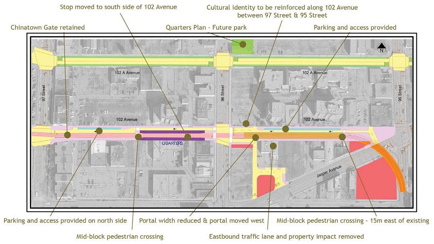
Tomorrow a report on the LRT Central Area Circulator is going to the Transportation & Infrastructure Committee. The Circulator would essentially cover the route I’m talking about – downtown to Old Strathcona. Here’s a look at the map:

The highlighted section would extend from the current Health Sciences Station west to the Bonnie Doon Station on the Southeast LRT line. The alignment for this extension has not been identified yet, but it looks from the map as though it might run slightly south of 82 Avenue. The report highlights the importance of this segment:

Lack of clarity regarding this segment of the LRT network creates public uncertainty. Developing an alignment in full consultation with community stakeholders will improve public understanding around the network, particularly regarding the alignment through the Strathcona and University areas and how the line will cross the river near 109 Street. Designation as a future LRT connection to the Southeast and West LRT line would clarify land use expectations and improve the likelihood of densification and other transit oriented development.

While the recommendation is simply to receive the report, it sounds like funding may finally be coming to allow Administration to move forward:

In order to complete this planning exercise, a one-time budget request is included in the 2013 Operating Budget as an Unfunded Service Package. This budget would be used to retain a consultant to develop an alignment recommendation for the Central Area LRT Circulator.

I think this extension to the LRT would make a lot of sense, but it’s still a long way off. In the meantime, I think either more frequent bus service or additional bus routes between downtown and Old Strathcona would be welcome.

There are two other options worth mentioning. The first is that you could cycle the trip from downtown to Old Strathcona, which Google Maps estimates would take 18 minutes. That’s less than ideal in the winter, but it could be done. Cycling is definitely something I’d like to do more of next year, and it’s exactly this kind of trip that cycling would be perfect for.

The second option is the High Level Streetcar. From the May long weekend until Labour Day, it runs daily every forty minutes (between 11am and 3pm, except during the Fringe when it runs until 10pm). I think the Edmonton Radial Railway Society does a great job running the line, but perhaps we should operationalize it. The track is already there, and while there’s not much in the way of stops along the way, the route is great for getting from downtown to Old Strathcona and back again.

It shouldn’t be so hard to take transit across the river!

The story of how I fell out of love with driving

When I got my current car, a 2005 Honda Civic, my Dad bought me a gas mileage book and told me to record each and every time I filled up. I have been diligently recording the date, odometer reading, number of litres, gas price per litre, and total cost of each fillup ever since. I also record notes on some fillups, such as out-of-town trips. A couple of weeks ago, inspired by Nora Young’s trip to Edmonton to discuss self-tracking, I finally decided to digitize the records. It occurred to me that this was the first bit of self-tracking I ever did. I know that I drive far less today than I did when I got the car, and I wanted to be able to visualize that. You can see the charts below, but to really understand them, I need to share a bit of history with you first.

The moment I turned 14, I was ready to get my learner’s permit. Like most guys my age I desperately wanted to drive, even if I needed to have an adult with me. I got the study guide, but didn’t spend too much time with it. As a result, when I went to write the test, I failed by one question (it was something to do with uncontrolled railway crossings if I remember correctly). I made sure to not let that happen again, and the second time I passed with no problems. I was living with my Grandma at the time, and she was great about letting me drive. Whenever we went to the grocery store or if she was dropping me off somewhere, she’d happily take the passenger seat.

I took lessons from AMA to learn how to drive a manual transmission, and took the driver’s test soon after I turned 16. With only a few minor hiccups I passed, and was free to drive on my own (fortunately I got in just before the GDL program took effect, so I had no limitations). When I was in high school, I drove a lot. I thought nothing of crossing the city to get somewhere or to drive a friend home. Gas prices were quite a bit lower at the time than they are today, but looking back it still seems incredibly wasteful how much I would drive.

When I started attending the University of Alberta, I would frequently drive. Sometimes I’d park at campus, other times I would get a ride with a friend, but most times I would park at the Stadium LRT Station and take the train the rest of the way (also handy because my office was downtown). I would sometimes take the bus, but I never made that a habit.

Shortly after I graduated in the spring of 2007, I started working at Questionmark. Our office was located near The Brick warehouse in the northwest part of the city, and I was still living with my Grandma in the southeast. That meant driving about 60 kilometers every day, and it meant driving the very busy Whitemud. I looked at taking the bus, but it would have taken about 45 minutes and required a transfer.

In May 2008, I moved into an apartment in Oliver with my sister. That cut the distance to work significantly, though I still drove every day. Roughly a year later, with our local team growing at Questionmark, we decided to move the office downtown to the Empire Building. I started taking the bus to and from work every day, because it was just a short trip (about a 15 minute ride) and I didn’t want to pay for parking.

In the summer of 2010, Sharon and I moved into our current place on 104 Street. I’m now just a short walk away from the office (Google estimates 9 minutes), which means I walk to and from work every day. As we have written before, I absolutely love it.

To recap quickly:

  • June 2005 to July 2007: I drove pretty much everywhere.
  • July 2007 to May 2008: I drove across the city to get to work every day. I regularly drove other places.
  • May 2008 to May 2009: I still drove to work every day, but the distance is much shorter.
  • May 2009 to July 2010: I took the bus to work, and drove only on evenings and weekends.
  • July 2010 to present: I walk to work, and avoid driving whenever possible.

Here’s what that behavior looks like on a graph:

distance by year

I think the four big shifts are pretty evident in that graph. Slowly but surely, I have been reducing any dependence on my car to get around.

Out of interest, here’s what that behavior cost me at the pump:

spend by year

I wish I had kept records prior to 2005, because I know the price of gas was quite a bit less when I first started driving.

What’s not captured in this data is how my attitude toward driving has changed over the years. It sounds counterintuitive, but the less time I spent behind the wheel the less I enjoyed it. I remember arguing with Sharon back in my university days about how terrible our public transit system was (she has always been a regular user). I loved driving and wanted nothing to do with the bus. Today we use the car maybe once a week, for trips to Superstore, to visit family, or to get out of town, and I regularly complain if I need to drive for pretty much any other reason. I would much rather walk or take the bus. I now find driving quite stressful! I’m sure that the shift from driving to walking has positively impacted my health. It has no doubt lowered my carbon footprint by quite a bit as well.

Also missing from the above charts are the other changes that have made my move away from the car possible. Without question, being able to use Google Maps to lookup bus routes has been hugely beneficial. Text messaging at bus stops has also made the experience of using the bus much more positive. My experience traveling in other cities has no doubt had a big impact on me as well. The are lots of things to consider.

As much as I would like to go car-free, it’s just not a very realistic option in Edmonton at the moment. I’m hopeful that will change however, and that our next car will be our last (though I recognize that other life changes may significantly affect that plan).

In an effort to better understand my behavior and potentially change it, I have been tracking my travel habits every day this year. In January, I’ll be able to show you a full year of data, including how often and how far I traveled by foot, bicycle, automobile, bus, train, plane, etc. Stay tuned!

The Downtown LRT Connector should run along 102 Avenue

Today City Council is scheduled to vote on the recommendation from the Transportation & Infrastructure Committee to shift the route of the Downtown LRT Connector from 102 Avenue up to 102A/103 Avenue. I’m opposed to this change for a variety of reasons. Here’s what the Journal’s Editorial Board wrote on February 2:

Responsive government is indeed a positive thing, but Edmonton’s city council has done far too much listening at the expense of decisive action on the LRT file. Councillors approved the current east/west downtown leg along 102nd Avenue in 2010 – yes, two years ago – but on Tuesday the smaller transportation committee voted to recommend a route shift and other changes that could increase the project’s cost by $115 million and delay construction by at least a year to entertain more discussion and allow for further planning.

We know that LRT is our top priority, we know that LRT is vital for our city’s future as an enabling technology for our urban centre, and we know it will only get more expensive to construct over time. Further delaying this important infrastructure is not the correct course of action.

I am certainly not a fan of the way the City does public involvement (though there have been some more positive signs lately) but they did do a lot of consultation on this project. It is disappointing to see that if one group screams loud enough, they can render the rest of the consultation process irrelevant. It sets a dangerous precedent for future LRT construction too.

downtown lrt connector

The route that Transportation officials recommended back in 2010 makes the most sense to me. Here are some of the reasons you can find in the report:

  • 102 Avenue is already more developed than 102A Avenue, which means ridership potential is greater along 102 Avenue.
  • Related to that – all of the destinations are along 102 Avenue! The City notes there are 10 activity centres along 102 versus just 3 along 102A. Churchill Square, the Stanley Milner Library, the Citadel, the Winspear Centre, City Centre, the YMCA, Norquest College, the City Market in the summer, the Edmonton Chinatown Multicultural Centre, etc., are all along 102 Avenue.
  • 102 Avenue is closer to Jasper Avenue, and therefore closer for riders to make connections to other routes. 102 Avenue can connect directly to Churchill Station. I also like that 102 Avenue is half-way between 104 Avenue and Jasper Avenue, which will aid connections to MacEwan, the Arena & Entertainment District, etc.
  • Any option other than 102 Avenue will require an amendment to the Transportation System Bylaw and an amendment to the Capital City Downtown Plan. This would further delay any construction on LRT.

There are three key reasons that Council should vote against changing the route from 102 Avenue:

  1. 102 Avenue is more developed, has more people living and working along it, supports connections to existing transit best, and supports the Capital City Downtown Plan best.
  2. The 102A/103 Avenue route would add significant cost and further delays to the construction of this route.
  3. Changing course now sets a dangerous precedent that could negatively impact further LRT construction.

I strongly urge City Council to vote against the recommendation to change the route from 102 Avenue to 102A/103 Avenue.

UPDATE: Well that was a quick meeting! Council voted to keep the route along 102 Avenue as originally proposed. Excellent news!

More than 3 million text messages were sent for ETS bus schedules in 2011

A little over a year ago Edmonton Transit (ETS) introduced bus schedules via text message. Simply send a message to 31100 from your cell phone with the bus stop number, and ETS will respond with a list of upcoming routes and times. It’s a fantastic service that I have used dozens of times over the last year, and clearly I’m not alone. A little over 3.1 million messages were sent last year! Here’s the monthly breakdown:

ets text messages in 2011

Back in June, when I wrote about the launch of the advertising component to the service, about 1.2 million messages had been sent, or 7050 per day. By the end of the year, the daily average had risen to 8494. You can see that the increase is due in large part to the back to school season – the number of messages sent jumped from 225,730 in August to 333,877 in September.

As expected, increased use of the text messaging service has led to a decrease in the number of calls made to BusLink, the automated 24-hour telephone line for transit information. Nathan Walters from ETS told the Journal that the number of calls dropped by 340,000 in the first nine months of last year to 2.8 million. I suspect it dropped even further when school started up again.

It’s great to see people embracing initiatives like this! ETS recently launched an updated Trip Planner that contains a number of new features like the ability to subscribe to email alerts for planned detours and bus stop closures, and there are additional technology-related services on the way. Should be an exciting year for connected transit riders!

Photo Tour: ETS Centennial Garage

About two months ago at the Youth Summit on Sustainable Transportation I had the opportunity to tour Edmonton Transit’s Centennial Garage, located at Ellerslie Road and 156 Street. The name commemorates Edmonton Transit’s 100th anniversary of service. The facility, which officially opened on April 10, 2010, primarily serves neighbourhoods in the west and southwest parts of Edmonton.

ETS Centennial Garage

The garage has space to store and maintain at least 250 buses, but is also home to administration offices as well as dispatch and support. More than 250 fleet services and bus operations staff work at the facility (that includes 200 operators).

ETS Centennial Garage ETS Centennial Garage

The building is massive, encompassing 7.1 acres (or 313,000 square feet, approximately five football fields). The budget for the garage was $99 million, $89.3 million of which came from the Municipal Sustainability Initiative (MSI). It was designed and built to LEED Silver standards, with features such as a solar wall for heating. Croy D. Yee Architect Ltd, Morrison Hershfield Limited, Earthscape Consultants, and Clark Builders were involved in the design and construction of the building.

ETS Centennial Garage

Some of the building materials used include 31 miles of electrical conduit, 1325 imperial tons of steel (structural steel was made up of 90% recycled content), 11,800 cubic metres of concrete (27.5% was reycled content), 3300 sprinkler heads, and 81 miles of in slab heating pipe.

ETS Centennial Garage

The Centennial Garage is the first garage in Edmonton designed to handle ETS’ 13 articulated buses, with a special hoist that can lift the 20-metre, three-axled vehicles.

ETS Centennial Garage

The storage part of the garage was fairly empty when we visted, as most buses were out on the road. It as neat to see the buses that were present parked nose to tail in long lines.

ETS Centennial Garage

ETS Centennial Garage

The high pressure wash system is what gets the buses nice and clean on the way into the garage. Apparently they had to turn the pressure down from the original setting, because it was causing the decals and advertising on the buses to come right off! In addition to being powerful, the system was specifically designed to cut down on water use by more than half.

ETS Centennial Garage

There are state-of-the-art systems in the building for monitoring carbon monoxide levels and maintaining comfortable heat and humidity. Energy modeling results indicate that the Centennial Garage is 33% more energy efficient than a typical building of its size and type.

ETS Centennial Garage

The ride out to the garage seemed to take forever (it’s really far south west) but it was definitely worth it to get a closer look at one of the facilities that keeps ETS running smoothly!

ETS Centennial Garage

You can see more photos from the tour here.

Edmonton Transit (ETS) Text Messaging: Statistics & Advertising

About six months ago, Edmonton Transit launched its text messaging service which enables riders to get schedule information via a simple SMS text message to 31100. The service was really well received, even though it was described by ETS as a pilot. I use the service almost every time I need to hop on a bus, and it works great! I’m definitely not the only one using the service either, as the latest statistics show.

usage stats

You can see that the initial growth was quite impressive, with usage doubling from January to March. Nathan Walters, Strategic Marketing Supervisor at ETS, told me that the adoption curve was “slightly steeper than expected” but that it is following projected usage quite closely. Since then usage has plateaued a little, probably due in part to the school year ending. Nathan said that usage of the service is probably going to be somewhat seasonal, just like BusLink.

As of Monday afternoon, just over 1.2 million messages had been sent, which works out to about 7050 messages per day. For comparison, Winnipeg Transit was delivering about 6000 messages per day back in May. Not a bad start at all!

text ads

When the service launched back in January, ETS said it would open up the ability to advertise on the text messages some time in the spring (the last 40 characters of each message are reserved for advertising). That service officially launched on June 17.

Advertising on the ETS Text Messaging Service provides a direct way to reach thousands of commuters riding the transit system every day. As an ETS text messaging advertiser, you have the opportunity to customize your campaign by location, time, bus route and even budget. This opportunity is affordable, tailored and easy to manage.

You can register for an account here and start advertising right away. The price can be as low as a penny per ad, but it is market-driven. Basically you buy credits and then place bids. You can customize your ads by specific bus stops, routes, time, and mobile phone provider. There’s a user guide in PDF here with more information.

demographic stats
(click for a larger version)

I’d encourage you to check out the Text Messaging Ad Media Kit in PDF too, as it contains a ton of useful information about the service. Some of the demographic information is a bit old, but it is still instructive.

You can learn more about the ETS text messaging service here.

St. Albert Transit launches real-time GPS information with NextBus

Today St. Albert Transit officially launched its NextBus service, giving transit riders the ability to find out exactly when a bus is arriving. All 55 StAT buses have been outfitted with Automatic Vehicle Locators, the hardware that uses GPS to provide information about a bus’s actual location. St. Albert is the second municipality in Alberta to launch the service. Banff, Guelph, Thunder Bay, Toronto, and Laval all offer a similar service.

From the press release:

“No one likes to wait for the bus more than they have to so people using StAT transit will find NextBus will save them time,” says Bob McDonald, Transit Director at the City of St. Albert. “We are pleased to be among the first municipalities in Canada to offer such a service.”

Transit riders can use the NextBus website to get arrival times. It’s not pretty, but it works! You can either enter your stop number, or pick a route, direction, and stop name to find out when the next bus is arriving. The page will tell you in large type when the next bus is arriving, and also provides links to a Google Map and a Live Map. You can see the system-wide maps here: Google Map, Live NextBus Map. You can also sign up for myNextBus, a service that can send you an alert when your bus is about to arrive. In addition to the main website, NextBus has a mobile-ready website as well. In the US they also offer SMS functionality, but unfortunately it doesn’t work in Canada.

What about an API? The documentation is pretty much non-existent, but there appears to be a NextBus API available. You can read about it on the San Francisco Municipal Transportation Agency (SFMTA) site. I tried to use the appropriate parameters for St. Albert, but found that it doesn’t work. I contacted StAT to find out more. It turns out that the API is extra functionality that NextBus charges extra for. Dawn Fedorvich, Coordinator of Customer Service for StAT, tells me that they’re looking into it. In the meantime, contact StAT to let them know that you think having access to the API is important! Earlier today David Eaves wrote about the “arrivals board” that the University of Alberta Students’ Union has created using the City of Edmonton’s GTFS data. That’s just scheduled information, however. Imagine that board being real-time – that’s the kind of thing the API would enable!

StAT has been testing the NextBus service since April 1. A total of 340 testers used the service 4500 times during the beta period. They started exploring the service in 2008, and have spent $170,000 since that time to make the service a reality for StAT riders. I think it’s a very positive thing for all transit riders in the Capital Region. I know AVL/GPS technology is on the roadmap for ETS as well, so let’s hope this news puts a bit more pressure on them to get it done. Congrats to StAT for leading the way!

Check out the new service here!

Leading the Way: LRT Dance Party in Edmonton

Ever wonder what a dance party on the LRT would look like? I had the opportunity last weekend to find out! The Saturday evening activity for delegates of the 2011 Youth Summit on Sustainable Transportation was a DJ Dance Party on a chartered ETS LRT train.

LRT Dance Party

While we were touring the D.L. MacDonald LRT Garage in the afternoon, staff were busy getting the train prepared, adding streamers, disco balls, and lights to the interior. DJ Rob Wong also got setup with all of his gear and two giant speakers, one at each end of the train. After a quick dinner, we all boarded the party train! The train circled the garage a few times, apparently to make the most of our time.

LRT Dance Party

We then travelled the length of the LRT line, from Clareview all the way to Century Park, before travelling back as far as Churchill Station to let some people off downtown. In all, we spent about an hour and half on the train.

The music was loud, and slowly but surely most people started dancing! It was easier than you’d think to dance on the moving train, though whenever there was a sudden jolt it was just another reason for everyone dancing to yell and cheer. There were a few people who chose to just sit through the entire experience. It kind of reminded me of a high school dance in that way – slow to get going, with some people sitting off to the side the entire time.

Here’s DJ Rob doing his thing:

LRT Dance Party

Most of the dancing happened as we passed through a station. People on the platform would look at the train with bewilderment, and occasionally someone would give a thumbs up or clap. Faces filled with confusion just made everyone on the train dance and cheer even more! It became pretty obvious who among us were the exhibitionists. Here’s what it looked like for someone on the platform:

Unsurprisingly, the best part of the trip was the underground portion where it was darker. Tinted windows, dimmed lights, and some…uh, lubricant…would have made the dance party more like a dance party and less like a bunch of people moving around on the train! Maybe I’m just getting old.

That said, it was still a lot of fun. I absolutely love the concept of taking the LRT, normally seen as somewhat mundane (trains just get you from A to B), and using it for a completely different purpose. I think everyone enjoyed themselves! Obviously ETS doesn’t normally charter trains for this purpose, but I think they could if they wanted to. It’s certainly a unique experience!

You can see more photos here, and see more videos here.

Leading the Way: 2011 Youth Summit on Sustainable Transportation

This weekend at the Lister Conference Centre on the University of Alberta campus, about 56 youth from across the prairies and territories are gathered to learn about and discuss public transit and sustainable transportation. Leading the Way is the first regional summit to take place in Canada, other chapters of the Canadian Urban Transit Association will follow suit with their own events later this year.

LTW Youth SummitLTW Youth Summit

The conference kicked off last night with opening remarks from Charles Stolte, Manager of Edmonton Transit and Chair of the Canadian Urban Transit Association. He welcomed everyone and shared a few anecdotes from his many years of transit experience. We also heard from Kevin Joll, Manager of Red Deer Transit. He talked about the organizations Vision 2040, an initiative to define the role of public transit in Canada for a 30-year time horizon. He shared this video with us:

Next up was our keynote speaker, Edmonton City Councillor Don Iveson. He spoke about “making a difference” and shared some of his experiences with bringing the U-Pass to life. He had four main pieces of advice for delegates:

  • Make a strong argument.
  • Be patient.
  • Have fun.
  • Walk the talk.

He noted that it takes time for public transit projects to happen, so even if you make a strong argument you need to be patient. Having fun can help you be patient, and there’s no better way to destroy a strong argument than to not walk the talk!

LTW Youth Summit

His slides were fantastic, and contained lots of little nuggets:

  • “You come out ahead when you invest in public transit.”
  • If everyone around the world lived the way we do in Edmonton, we’d need about 4 planet Earths to sustain ourselves.
  • A bus with 12 people is a better investment than a Prius with 4 people. LRT, of course, is even better.

He closed with his popular video on transportation that uses Lego!

The rest of the evening was devoted to brainstorming on the six major questions posted to delegates. The questions align with Vision 2040, and by the end of the weekend each group is going to have a pitch ready to make in a Lion’s Lair competition. It should be interesting to see what everyone comes up with!

LTW Youth Summit

The conference runs all weekend, and includes tours of the D.L. MacDonald LRT Garage and the new LEED-certified Centennial Garage. There’s also going to be a dance party on a chartered LRT car! You can follow along on Twitter using the hashtag #LTWSummit. I’ll be posting photos of the event here.