Last night City Council voted in favor of changing from the current 6-ward system to the more common 12-ward system used throughout North America. The change will take effect for next year’s municipal election. For more background, check out Dave’s post. You can also check out the City of Edmonton’s page for more information.
As an advocate of open data, I thought I’d share with you some data related to the new wards below. All of the data is available on the City website somewhere, but not in an easily consumable form. I’ve done the legwork to make it accessible.
Amendments made to the motion last night affected the wards a little:
- Grovenor and McQueen neighbourhoods moved from Ward 1 to Ward 6.
- CPR West moved to Ward 8 from Ward 10.
- Calgary Trail North and Calgary Trail South moved from Ward 11 to Ward 10.
- Some ravine boundaries were changed from “in-the-middle” to “top-of-bank”.
Here are the stats on the new wards:
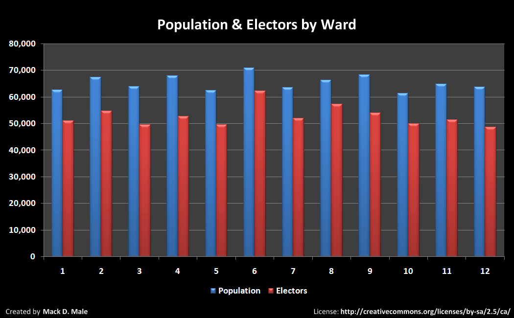
In a table (download CSV file here):
| Ward | Population | Electors |
| 1 | 62,625 | 51,061 |
| 2 | 67,306 | 54,704 |
| 3 | 63,819 | 49,465 |
| 4 | 67,811 | 52,666 |
| 5 | 62,424 | 49,615 |
| 6 | 70,840 | 62,152 |
| 7 | 63,549 | 51,865 |
| 8 | 66,196 | 57,189 |
| 9 | 68,214 | 53,889 |
| 10 | 61,276 | 49,935 |
| 11 | 64,770 | 51,329 |
| 12 | 63,609 | 48,529 |
The average population of each ward is 65,203 and the average number of electors for each ward is 52,700. This data comes from the 2009 Municipal Census.
Here are the number of neighbourhoods in each ward:

I’ve also compiled a list of neighbourhoods in each ward which you can download in CSV here. Or if you’d rather just look, you can download the list in PDF here.
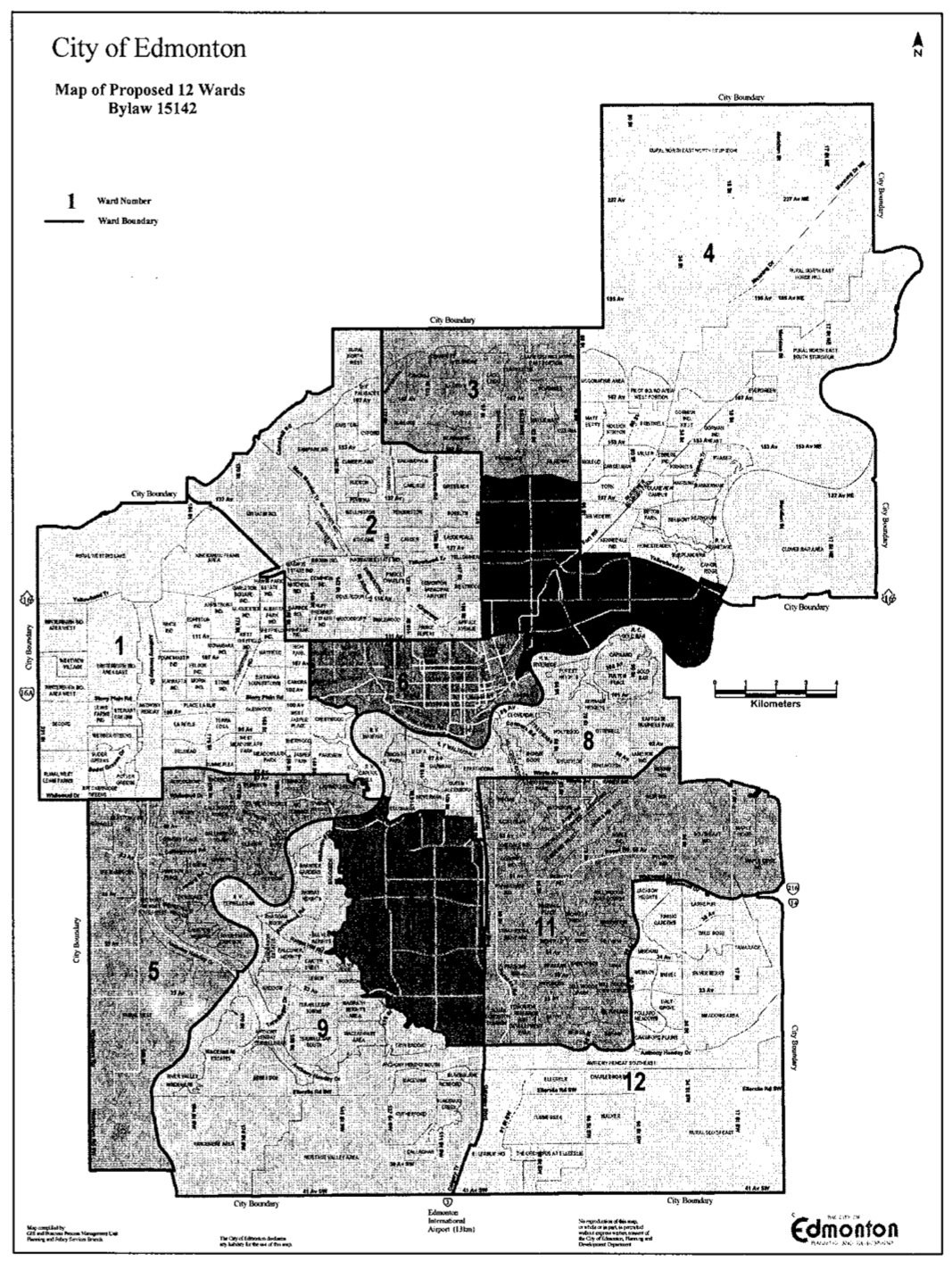
I’m trying to track down or create a good quality map of the 12 wards, but this’ll have to do for now. What I’d really love is lat/long coordinates for each ward. If you have something better than that graphic, let me know!
Go do something useful or interesting with this data, and then tell me about it. I’m looking to collect local examples to strengthen the case for open data at the City of Edmonton!
UPDATE: Here’s a better map in PDF format.
UPDATE2: Here’s an even better color map showing the wards and neighbourhoods in PDF format.

One thought on “Data on Edmonton’s new 12-ward system”